As we motored along the Gordon River Road, through the sleety rain we noted Scotts Peak Road, a left hand turn-off which we expected to follow on day two in order to begin to appreciate the scale of the current Lake Pedder.  Every twist and turn in the road offered more vistas.

 After continuing along through the variously forested landscapes, the road turned a corner and our breath was taken away. I declared that what I was seeing was likely to be the highlight of our weekend. We were approaching The Sentinels. Startlingly magnificent. The scale of the Sentinel range that is visible from the road, its closeness to the road, and the height is stunning.
We saw it as follows: 


 We were so awestruck that Jeanette stopped the car and I walked uncaring into the rain and tried to take a range of photos. Of course a sentinel’s job is to stand and keep watch but it was my job that day to stand and watch.
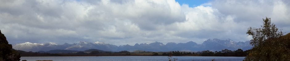
 The following panorama style photograph appears to have shrunk the range.
 Sorry about the tree in the middle of the photo; I was so mesmerised by The Sentinels I did not see it in the frame.
In the map below, the range of mountainous crags immediately below the Wedge River Picnic Area is the Sentinels. In the online magazine Tasmanian Geographic, Sam Wilkinson describes The Sentinels as offering the best day walk in Tasmania. Nermut and McKenny provide directions for climbing this range here.
Bushwalk Track Notes adds important information here, and a map pinpointing the main walking area is located here.
Once back in the car I was aglow with the stimulation of the cold rain on my skin and from being excited by the immediacy of the vertical row of rocks stretching across a great distance.
On Day 2, when we neared The Sentinels on our way to Scotts Peak Road, snow had wafted over this range creating a new look.

